My thoughts on today's shower/thunderstorm potential haven't changed much since yesterday
i.e. good chances near, and south of the border (moreso over inland higher ground), moderate chances in southern parts of SEQ, close to 50/50 for Brisbane itself, and slight chance for northern SEQ such as the Sunshine Coast.
But as I mentioned previously, I'm always cautious about the northern end of these setups because it doesn't take much for that section to be vulnerable to downgrades.
Apart from the more obvious aspects of the setup (significant coastal capping but a bit weaker inland, dry low levels and momentum transfer of strong winds aloft leading to elevated risk of strong gusts under any storms, low rainfall/dry lightning potential, etc),
a few things that make me a bit more optimistic than I'd otherwise be for these setups include the cold midlevel air moving across which may help things a bit despite the marginal moisture and capping here and the reasonable multimodel PoP values for southern parts of SEQ (although it'd be good if the current patchy mid and high cloud in the south wasn't there), and the post-seabreeze front higher dewpoint surface air infiltrating a fair way inland in southern SEQ after it merges with the weakening approaching coastal change, as well as the seabreeze front itself.
Shear and the W to NW steering winds are also strong which would help rapidly advect any activity towards parts of the coast although it'd mean that southern coastal parts would be more favoured.
So I still think the most likely scenario will play out in this order:
1. Some high-based popcorn convection (due to marginal moisture) initiates over inland higher ground mainly in the south (near the QLD/NSW border), the northern NSW tablelands, and possibly also in western parts of SEQ/far eastern Downs where the cap is weaker.
2. This activity then rapidly moves E (then later, ESE or SE) on the strong steering winds aloft.
3. The activity may become a bit more numerous as it get closer to the coast and encounters the seabreeze front and more moisture (but the stronger cap near the coast makes this less than certain).
4. Later in the afternoon or evening, this activity may eventually reach some sections of the coast as gusty low-rainfall showers or storms but if the cap is too strong near the coast, there is the risk these storms may die before reaching there.
Timing looks a bit tricky IMO - I often find initiation tends to be delayed during dry setups but on the other hand, you have the strong steering winds which may advect any activity towards the coast earlier than expected.
I'm not certain yet if it'll play out this way though given the marginal moisture and capping around.
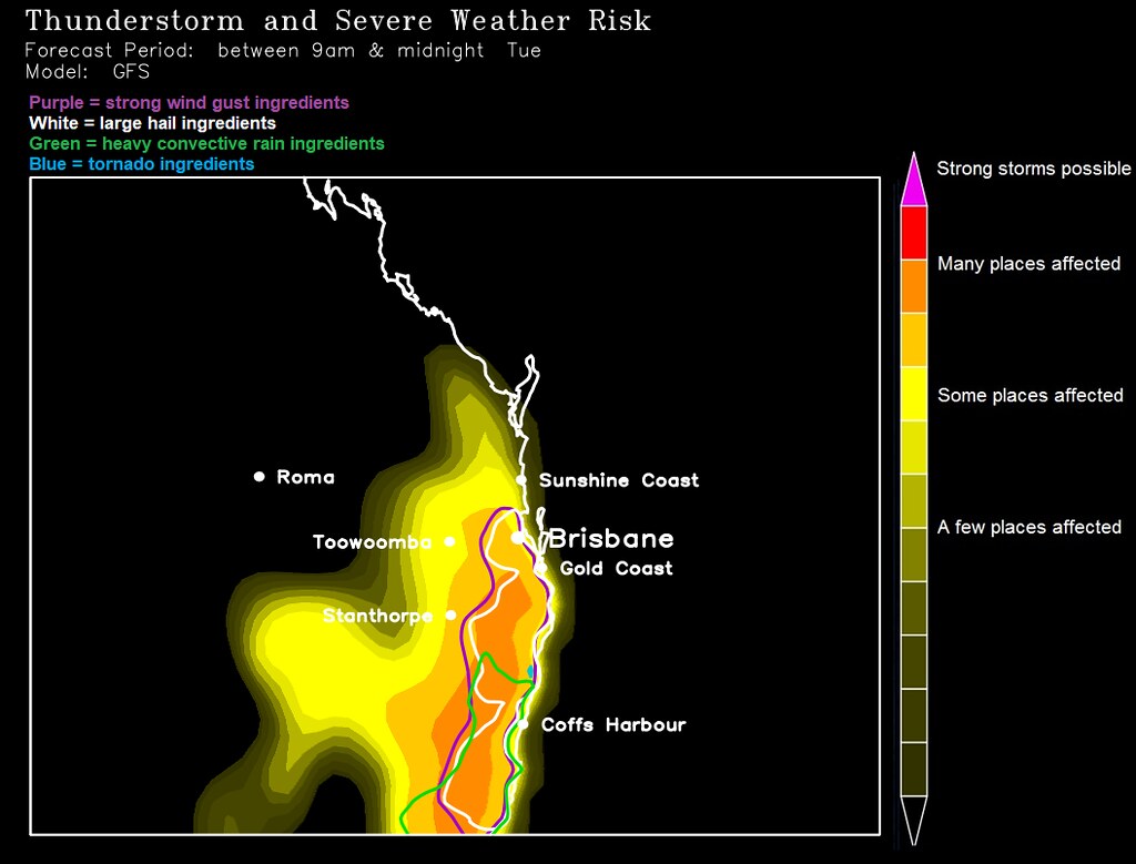
Above is an output using convective cold cloud depth calibrated to past lightning - if I were to manually adjust anything, it'd probably be to shrink the northern, western, and coastal margins of the higher probabilities inwards a little bit, and tone down the higher probabilities in SEQ (and also shrink the area of hail ingredients in a bit as well).
