Weather Forum
»
Australia Weather
»
SEQ and NE NSW
»
SE QLD and NE NSW - Day to Day Weather
Rank: Advanced Member
Groups: Registered, Administrators Joined: 21/08/2019(UTC) Posts: 941  Location: Brisbane Northside Thanks: 1198 times
Was thanked: 1136 time(s) in 674 post(s)
|
Originally Posted by: retired weather man  Somewhat surprising about a frost in Cairns itself, as its min this morning was 7.9C. The lowest air temp for a possible frost is 2C. Maybe up on the Tablelands, but not Cairns with a temp like that. Yes you are absolutely correct RWM. I wish I had screenshot the 1st story that circulated as it stated Cairns. As my father-in-law grew up in Cairns and has seen frost at the Race Course so I assumed it was correct. The updated story has now stated it was the Atherton Tablelands which recorded minus 2°C at the Caravan Park. My wife’s Grandparents lived on the Atherton Tablelands. We have done a few trips up but not since the late 1990’s. The Atherton Tablelands is not Cairns. We went up there one year and I got caught out with how cool the day was up at that elevation in July. That is so annoying when a reckless story is posted on the news. The only thing is it was cold in Cairns at 7.9°C. It is a beautiful sunny day over BR right now. Just had a look at the QLD forecast and SEQ could see a very slight chance of a TC on Tuesday and Wednesday. It is very slight. My feelings right now would suggest a dry TC “IF” it can come together. Having a look at the LI,s and Cape and forecast soundings, Wednesday looks like the best possible chance but it still looks slim. |
Colin Maitland. |
|
|
|
|
|
Rank: Advanced Member
Groups: Registered
Joined: 21/08/2019(UTC) Posts: 182 Location: Wynnum North Thanks: 656 times
Was thanked: 381 time(s) in 167 post(s)
|
WYNNUM NORTH ( 27.4S 153.2E ) - WEATHER
DATE....24 AUG 2019...TIME...0830
CURRENT TEMPERATURE...14.8C
CURRENT HUMIDITY........70%
CURRENT DEW POINT........9C
CURRENT WIND SPEED/DIR...WSW 10Kph
CURRENT MSL PRESSURE...1026.5Hpa
CURRENT VISIBILITY......25Km
CURRENT CLOUD..........1/8 Cu, 4/8 Sc
CURRENT WEATHER......Smoke haze
RAIN SINCE 0900 FRIDAY..0.0mm.
SUMMARY LAST 24 HOURS ......22.0C
THIS MORNING'S MIN TEMP......8.7C
PAST 24 HOUR TEMP.ANOMALY..-0.95C
THIS MORNING'S GRASS MIN.....8.1C
AVERAGE 24 HOUR DEW POINT......9C
AVERAGE 24 HOUR MSLP.......1026.5Hpa
MAX WIND GUST LAST 24 HOURS..E 35Kph at 1256
PAST 24 HR SIGNIFICANT WEATHER..Smoke haze. |
Wyn Nth 2020-Jan165, |
|
|
|
|
|
Rank: Advanced Member
Groups: Registered
Joined: 23/08/2019(UTC) Posts: 155 Location: Narangba Thanks: 280 times
Was thanked: 442 time(s) in 136 post(s)
|
Originally Posted by: Colmait
Just had a look at the QLD forecast and SEQ could see a very slight chance of a TC on Tuesday and Wednesday. It is very slight. My feelings right now would suggest a dry TC “IF” it can come together.
Having a look at the LI,s and Cape and forecast soundings, Wednesday looks like the best possible chance but it still looks slim.
Thank you for the heads up Colmait. I am still leaning the whole Cape, LI and convection thing, but I will have a look at the charts and see if I can come to the same conclusion. Any knowledge from you and others is greatly appreciated! Hopefully after the fires this week and the continuing dry conditions, we do not have dry storms with next to no rain reaching the ground level. I guess this is a reminder for me to go and clean the gutters, because the gum trees have filled them up with the recent wind.
|
|
|
|
|
|
Rank: Advanced Member
Groups: Registered
Joined: 23/08/2019(UTC) Posts: 155 Location: Narangba Thanks: 280 times
Was thanked: 442 time(s) in 136 post(s)
|
Originally Posted by: Pharbelle
Glad all is ok with you and the cats CSNarangba.
The cattery already had a bush fire evacuation plan apparently, which is get everyone out and down to another cattery/kennels. Still lots of smoke around today from Bribie and my local fire.
|
|
|
|
|
|
Rank: Advanced Member
Groups: Registered
Joined: 23/08/2019(UTC) Posts: 59 Location: Sydney Thanks: 88 times
Was thanked: 88 time(s) in 40 post(s)
|
Wow. What a beautiful sky colour. Thank your for sharing.
|
|
|
|
|
|
Rank: Advanced Member
Groups: Registered
Joined: 24/08/2019(UTC) Posts: 292 Location: Country Victorian Thanks: 580 times
Was thanked: 503 time(s) in 194 post(s)
|
OH my , and yet another forum. That just has to be good.  Thanks for the invitation admin'. It makes you feel special. Its obvious you go back to places that treat you nicely. Nice format and some familiar names and climate change thread. Destroying the climate thread at WZ destroyed WZ l believe. The forum was always abuzz with the latest.. ..... Calendar spring is here next week and some changes on the surface synoptic appearing . A nice deep drop in isobars off the east coast of OZ this week. There is a tropical infeed into this tropical trough and the onshore flow looks quite moist on ACC g. Chances of precip' from Gippy' to just south of Townsville. 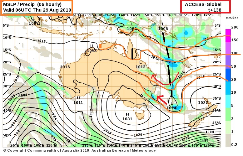
|
 3 users thanked crikey for this useful post.
|
|
|
|
Rank: Advanced Member
Groups: Registered
Joined: 21/08/2019(UTC) Posts: 182 Location: Wynnum North Thanks: 656 times
Was thanked: 381 time(s) in 167 post(s)
|
Originally Posted by: NoDrops Wow. What a beautiful sky colour. Thank your for sharing. That's the view from my front gate overlooking Wynnum North railway station. |
Wyn Nth 2020-Jan165, |
|
|
|
|
|
Rank: Advanced Member
Groups: Registered
Joined: 21/08/2019(UTC) Posts: 182 Location: Wynnum North Thanks: 656 times
Was thanked: 381 time(s) in 167 post(s)
|
WYNNUM NORTH ( 27.4S 153.2E ) - WEATHER
DATE....25 AUG 2019...TIME...0830
CURRENT TEMPERATURE...15.1C
CURRENT HUMIDITY........74%
CURRENT DEW POINT.......11C
CURRENT WIND SPEED/DIR...W 11Kph
CURRENT MSL PRESSURE...1022.1Hpa
CURRENT VISIBILITY......25Km
CURRENT CLOUD..........Nil
CURRENT WEATHER......Smoke haze
RAIN SINCE 0900 SATURDAY..0.0mm.
SUMMARY LAST 24 HOURS ......21.8C
THIS MORNING'S MIN TEMP......8.6C
PAST 24 HOUR TEMP.ANOMALY..-1.10C
THIS MORNING'S GRASS MIN.....8.0C
AVERAGE 24 HOUR DEW POINT.....10C
AVERAGE 24 HOUR MSLP.......1023.5Hpa
MAX WIND GUST LAST 24 HOURS..E 23Kph at 1307
PAST 24 HR SIGNIFICANT WEATHER..Smoke haze. |
Wyn Nth 2020-Jan165, |
1 user thanked retired weather man for this useful post.
|
|
|
|
Rank: Advanced Member
Groups: Registered
Joined: 23/08/2019(UTC) Posts: 155 Location: Narangba Thanks: 280 times
Was thanked: 442 time(s) in 136 post(s)
|
I am officially celebrating today as the start of spring (on my calendar anyway) with a large bacon and eggs breakfast. 27 degrees is forecast today, and Crikey and Colmait both saying a slight chance of a storm on Wednesday. The smoke from Thursday's fires near here has gone and the air feels clean again. Happy days.  Edited by user Sunday, 25 August 2019 8:55:57 AM(UTC)
| Reason: Brain, hand Nd keyboard issues.
|
|
|
|
|
|
Rank: Advanced Member
Groups: Registered
Joined: 21/08/2019(UTC) Posts: 185 Location: Ocean View Thanks: 359 times
Was thanked: 539 time(s) in 161 post(s)
|
Originally Posted by: CantSpellNarangba Happy days. Another cloud free Queensland day.  Source: OceanViewWeather
|
1 user thanked Pabloako for this useful post.
|
|
|
|
Rank: Advanced Member
Groups: Registered
Joined: 25/08/2019(UTC) Posts: 1,839 Location: Ferny Grove Thanks: 985 times
Was thanked: 856 time(s) in 419 post(s)
|
Thank you admin for inviting me here, so hello everyone. I might post my daily observations here also. I run a website from Ferny Grove (north west Brisbane) presenting real time data collected from my weather station and other weather related data and info at fernygroveweather.comFerny Grove Weather Date: 25 Aug 2019 Time: 9:25 AM Min Temp since 9am yesterday: 7.5 C Max Temp since 9am yesterday: 23.7 C Min Ground Temp: 5.5 C Rain since 9am yesterday: 0 mm Temperature: 21.1 C Relative Humidity: 48 % Dew Point: 9.7 C MSL Pressure: 1021 hPa Wind Speed: 3kph - light air Wind Direction: SE Present Weather: No cloud development observed Visibility: 40km or more - Excellent Visibility Cloud Cover: 0/8 Ground State: Ground dry Notes of yesterday weather - 24/8/19: Fine. Partly cloudy during morning with sc and cu easing later in the morning and clearing in the afternoon. Moderately low and stable dew point early rising to near average during the morning before falling from the mid morning to moderately low in the early afternoon. For the rest of the day the dew point was generally stable. Low daytime relative humidity. Some light NW winds in early hours before light S to SW in the early morning, E to SE in mid morning before E to NNE winds from late morning with some NW to NNE winds. Later in the afternoon winds were ESE to NE, becoming calm in the evening. |
|
1 user thanked Falling_Droplet for this useful post.
|
|
|
|
Rank: Advanced Member
Groups: Registered
Joined: 23/08/2019(UTC) Posts: 155 Location: Narangba Thanks: 280 times
Was thanked: 442 time(s) in 136 post(s)
|
Hi Falling_Droplet and it is great to see people slowly trickling onto this forum. Also, great to have a weather station in your part of the region. I haven't been out to Ferny Grove way for years and since the WoolShed has gone. I dread to think how many years that would be.
Not as warm here as BOM were forecasting today and only to 22 degrees so far. Perhaps there are a few more clouds floating past than were forecast.
|
2 users thanked CantSpellNarangba for this useful post.
|
|
|
|
Rank: Advanced Member
Groups: Registered
Joined: 24/08/2019(UTC) Posts: 292 Location: Country Victorian Thanks: 580 times
Was thanked: 503 time(s) in 194 post(s)
|
Great to see members chatting away. Good signs for a promising forum Here is ACC r for wednesday at 4pm. Certainly looks ok. The only issue is the very dry air, low dew points , dry air we have had. Wondering if this moisture can clear the dry out. It could be the difference between virga and a good storm. As for storm potential analysis, l wil,leave that to the storm experts.  But quite a few ticks here in my book some of my notes.. 'wednesday 28th aug 2019 tropical dip in isobars . Moisture infeed from the north coral sea Likely increase in dew points 2 small low pressure eddies on the trough line Max precip’ or storms most likely diurnal max in the afternoon. This is when ACC r has the strongest precip’ signal. The extent of the signal is quite broad , running from west of the divide at Townsville region right down to west of divide near Sydney. This signal extends to the coast.' http://www.bom.gov.au/au...harts/viewer/index.shtml
|
2 users thanked crikey for this useful post.
|
|
|
|
Rank: Advanced Member
Groups: Registered
Joined: 25/08/2019(UTC) Posts: 1,839 Location: Ferny Grove Thanks: 985 times
Was thanked: 856 time(s) in 419 post(s)
|
Originally Posted by: CantSpellNarangba Hi Falling_Droplet and it is great to see people slowly trickling onto this forum. Also, great to have a weather station in your part of the region. I haven't been out to Ferny Grove way for years and since the WoolShed has gone. I dread to think how many years that would be.
Not as warm here as BOM were forecasting today and only to 22 degrees so far. Perhaps there are a few more clouds floating past than were forecast. Thanks CantSpellNarangba. As far I am aware there aren't any other publicly available personal weather station updating in real time in my part of Brisbane. The woolshed closed I think in 2006 and now of course is a housing estate!  . Actually for many years the woolshed reported daily rainfall to the BoM, until the woolshed closed down: http://www.bom.gov.au/js...896&p_stn_num=040461The temperature rose to almost 25 C at 11am until some cu clouds developed and the temperature fell to 22 C. Clouds eased in afternoon and the temperature rose back to 25 C. |
|
1 user thanked Falling_Droplet for this useful post.
|
|
|
|
Rank: Advanced Member
Groups: Registered, Administrators Joined: 21/08/2019(UTC) Posts: 941 Location: Brisbane Northside Thanks: 1198 times
Was thanked: 1136 time(s) in 674 post(s)
|
The sounding for Brisbane has very slightly improved, but it is still marginal. There is only about 4 mm of rain at the most predicted for the storm so it has more of a chance of being a dry cell. That also posses problems as this could trigger a few fires. I am just hanging back a little just to wait for the next couple of updated runs. The latest sounding also shows the potential for the storm to basically choke itself pretty quickly. About the only thing that is being a constant in the scenario for any storm activity, if they can develop, is that they are most likely to be from 10:00 am to around 2:00 pm.
But once again I am waiting for the next 2 runs and updates to check the scenarios.
|
Colin Maitland. |
1 user thanked Colmait for this useful post.
|
|
|
|
Rank: Advanced Member
Groups: Registered, Administrators Joined: 21/08/2019(UTC) Posts: 941 Location: Brisbane Northside Thanks: 1198 times
Was thanked: 1136 time(s) in 674 post(s)
|
Beautiful colours in those photos RWM. Absolutely stunning and beautiful. Thanks for posting those. Edited by user Sunday, 25 August 2019 7:49:49 PM(UTC)
| Reason: Speilink plobrems |
Colin Maitland. |
|
|
|
|
|
Rank: Newbie
Groups: Registered
Joined: 25/08/2019(UTC) Posts: 2 Location: Maryborough, QLD Was thanked: 9 time(s) in 2 post(s)
|
Hi guys, good to be here. Here are my thoughts regarding Wed/Thur:
Just doing the early morning model roundup and noticed that last night's EC run actually doesn't look too bad particularly for Thursday afternoon and evening? Not a great deal of instability as to be expected at this time of year but surprisingly there's enough moisture even in the lowers there to tap into ahead of the dryline (finally we get a little ridge set up across the Coral/Tasman Sea to provide this) so we could even see some surface based convection rather than just the high-based [censored]which looks more likely on Wednesday (though I think we will still see some surface based convection on Wednesday, just very isolated and probably dependent on cloud cover). ICON looks very similar to this as well.
Then there's GFS which looks very different for Thursday which has the upper low pushing NE too quickly, dragging the dryline and associated drier westerlies through to the coast by early Thursday morning.
Anyway, it's good to finally have something other than cold nights and clear skies to talk about.
|
4 users thanked MegaMatch for this useful post.
|
|
|
|
Rank: Advanced Member
Groups: Registered
Joined: 23/08/2019(UTC) Posts: 59 Location: Sydney Thanks: 88 times
Was thanked: 88 time(s) in 40 post(s)
|
Originally Posted by: MegaMatch Hi guys, good to be here. Here are my thoughts regarding Wed/Thur:
... Hi MegaMatch and it is great to have some "model interpreters" arrive on this forum. Although I am Sydney based, I fly into Brisbane at 2pm on Wednesday  and knowing my luck, just in time for storms.
|
|
|
|
|
|
Rank: Advanced Member
Groups: Registered
Joined: 25/08/2019(UTC) Posts: 1,839 Location: Ferny Grove Thanks: 985 times
Was thanked: 856 time(s) in 419 post(s)
|
Ferny Grove Weather
Date: 26 Aug 2019
Time: 7:50 AM
Min Temp since 9am yesterday: 8.9 C
Max Temp since 9am yesterday: 25.2 C
Min Ground Temp: 6.4 C
Rain since 9am yesterday: 0 mm
Temperature: 13.1 C
Relative Humidity: 66 %
Dew Point: 6.9 C
MSL Pressure: 1019.9 hPa
Wind Speed: Calm
Wind Direction: Calm
Present Weather: No cloud development observed
Visibility: 40km or more - Excellent Visibility
Cloud Cover: 0/8
Ground State: Ground dry
Notes of yesterday weather - 25/8/19: Fine. Clear in the morning with cu clouds developing later in the morning and clearing in the afternoon. Variable temperature from late morning to mid afternoon. Stable and moderately low dew point early before rising to near average in the early morning and then fell in the mid morning close to average. The dew point was stable through to late afternoon and fell in the late evening to moderately low. Light and variable winds in the early morning before light E to SE from late morning. N to NE in winds from the late afternoon and N to NNW winds later in the evening. |
|
1 user thanked Falling_Droplet for this useful post.
|
|
|
|
Rank: Advanced Member
Groups: Registered
Joined: 21/08/2019(UTC) Posts: 182 Location: Wynnum North Thanks: 656 times
Was thanked: 381 time(s) in 167 post(s)
|
WYNNUM NORTH ( 27.4S 153.2E ) - WEATHER
DATE....26 AUG 2019...TIME...0810
CURRENT TEMPERATURE...16.5C
CURRENT HUMIDITY........77%
CURRENT DEW POINT.......12C
CURRENT WIND SPEED/DIR..WNW 9Kph
CURRENT MSL PRESSURE...1020.6Hpa
CURRENT VISIBILITY......20Km
CURRENT CLOUD..........Nil
CURRENT WEATHER......Smoke haze
RAIN SINCE 0900 SUNDAY..0.0mm.
SUMMARY LAST 24 HOURS ......22.6C
THIS MORNING'S MIN TEMP.....10.0C
PAST 24 HOUR TEMP.ANOMALY...0.00C
THIS MORNING'S GRASS MIN.....8.8C
AVERAGE 24 HOUR DEW POINT.....11C
AVERAGE 24 HOUR MSLP.......1019.6Hpa
MAX WIND GUST LAST 24 HOURS..NE 23Kph at 1245
PAST 24 HR SIGNIFICANT WEATHER..Smoke haze. |
Wyn Nth 2020-Jan165, |
3 users thanked retired weather man for this useful post.
|
|
|
|
Weather Forum
»
Australia Weather
»
SEQ and NE NSW
»
SE QLD and NE NSW - Day to Day Weather
Forum Jump
You cannot post new topics in this forum.
You cannot reply to topics in this forum.
You cannot delete your posts in this forum.
You cannot edit your posts in this forum.
You cannot create polls in this forum.
You cannot vote in polls in this forum.
Important Information:
The Weather Forum uses cookies. By continuing to browse this site, you are agreeing to our use of cookies.
More Details
Close
