Weather Forum
»
Australia Weather
»
SEQ and NE NSW
»
SE QLD and NE NSW - Day to Day Weather
Rank: Advanced Member
Groups: Registered
Joined: 25/08/2019(UTC) Posts: 1,839  Location: Ferny Grove Thanks: 985 times
Was thanked: 856 time(s) in 419 post(s)
|
Ferny Grove Weather Date: 18 Jan 2020 Time: 9:00 AM Min Temp since 9am yesterday: 19.8 C Max Temp since 9am yesterday: 30.4 C Min Ground Temp: 19.7 C Rain since 9am yesterday: 90.9 mm (78.2 mm from automatic gauge, below graph) Temperature: 22.7 C Relative Humidity: 90 % Dew Point: 21 C MSL Pressure: 1004.5 hPa Wind Speed: 3 kph - light air Wind Direction: S Present Weather: State of sky generally unchanged during preceding hour Visibility: 20km to 39km - Very Good Visibility Cloud Cover: 5/8 Ground State: Ground wet Thunder yesterday: Yes Notes of yesterday weather - 17/1/20: Mostly cloudy with cu and sc clouds. A light shower in the early hours, another in the late morning and in the late afternoon. In the evening were some light showers before a severe thunderstorm with heavy falls in the late evening followed by showers with heavy falls. 21 mm in 15 minutes to 10:57pm and 29 mm in 31 minutes to 11:13pm. A warm morning with mostly stable temperature early in the day. The temperature was very variable from the mid morning to early afternoon and rose and fell numerous times. The dew point was near average and mostly stable early in the day before rising during the morning becoming stabilising moderately high before falling for a brief period of time back to near average. In the afternoon the dew point slowly fell, became mostly stable from the mid afternoon and then rose back to moderately high in the evening. There was a temporarily easing of the dew point with the start of the storm before the dew point recovered. Relative humidity was near average from early in the day and became moderately high from the mid morning to the late afternoon and variable at times from the mid morning to the early afternoon. Relative humidity rose quite steeply during the evening. Mostly calm winds early in the day with some N to NW winds, E to NE winds during the morning with some N to NE winds. Winds were light E to ENE in the afternoon with some ENE to NE winds and E to NE in the evening. Winds were ESE to NE with the storm, N to NE from 11pm and SSW to SW after the storm. Today: Further rain with short period moderate to heavy falls at times between 12am and 1am and again at times between 3 am and 4am before light falls through to the 6am. The dew point fell from early in the day close to average before rising this morning moderately high. High relative humidity have been very stable from early today at around 92%. Light SW to NNW early in the day, SE to NE from 1am, NNW to WNW from 2am before calm winds, WNW to SSW from 3:30am, WSW to SSW from 4am before S to SW winds since 5am.  |
|
 2 users thanked Falling_Droplet for this useful post.
|
|
|
|
Rank: Advanced Member
Groups: Registered
Joined: 25/08/2019(UTC) Posts: 1,839 Location: Ferny Grove Thanks: 985 times
Was thanked: 856 time(s) in 419 post(s)
|
Monthly total of 114 mm is 78.6% of the monthly average and 91.9% of the long term median. Compared to the same time (up to day 18) in past Januaries the monthly total so far is the highest since 121.2 mm in 2017 and for the whole of past Januaries this is the highest since 136 mm also in 2017.
This is the wettest day since 143.4 mm on 24 February 2018 and for January the highest since 271.3 mm on 28 January 2013. |
|
2 users thanked Falling_Droplet for this useful post.
|
|
|
|
Rank: Advanced Member
Groups: Registered
Joined: 25/08/2019(UTC) Posts: 1,839 Location: Ferny Grove Thanks: 985 times
Was thanked: 856 time(s) in 419 post(s)
|
A cool day with the temperature a little variable and stable from the late morning and during this afternoon under cloudy skies. The temperature have been falling in the last half hour with a brief light shower at 5pm and followed by another with moderate to heavy falls currently. Rainfall since 9am is 3mm. The dew point rose during the morning and became moderately high before rising slowly from the late morning and stabilising since the mid afternoon at 22 C. Relative humidity have been high today which stopped falling in the late morning when it rose slowly through to this afternoon. In the last half hour the relative humidity have risen quickly and is currently 87%. Light S to SW winds in the mid morning became S to ESE with some S to SW winds later in the morning, S to SE in the afternoon with some E to SE winds and ESE to SE from the mid afternoon becoming E to ESE presently. |
|
2 users thanked Falling_Droplet for this useful post.
|
|
|
|
Rank: Advanced Member
Groups: Registered
Joined: 25/08/2019(UTC) Posts: 1,839 Location: Ferny Grove Thanks: 985 times
Was thanked: 856 time(s) in 419 post(s)
|
17.4 mm since 9am from showers later in the afternoon through to 6:30pm, with a total of 108.3 mm since last night. Maximum rain rate today have been 88 mm/hr at 5:35 pm. Following the showers the temperature have stopped falling and is slowly rising. The dew point fell with the showers back to near average and have been rising after the shower back to moderately high. Relative humidity rose with the showers before becoming stable at 91% following the showers. Light E to SE winds backing to S to SE at 6pm and then S to SW and then calm in the last hour. |
|
2 users thanked Falling_Droplet for this useful post.
|
|
|
|
Rank: Advanced Member
Groups: Registered
Joined: 25/08/2019(UTC) Posts: 1,839 Location: Ferny Grove Thanks: 985 times
Was thanked: 856 time(s) in 419 post(s)
|
|
|
2 users thanked Falling_Droplet for this useful post.
|
|
|
|
Rank: Advanced Member
Groups: Registered
Joined: 21/08/2019(UTC) Posts: 182 Location: Wynnum North Thanks: 656 times
Was thanked: 381 time(s) in 167 post(s)
|
WYNNUM NORTH ( 27.4S 153.2E ) - WEATHER
DATE...19 JAN 2020 TIME....0740
CURRENT TEMPERATURE...25.3C
CURRENT HUMIDITY........88%
CURRENT DEW POINT.......23C
CURRENT WIND DIR/SPEED..W 3Kph
CURRENT VISIBILITY......40KM
CURRENT MSL PRESSURE...1005.7Hpa
CURRENT CLOUD..........1/8 Fc, 1/8 Sc, 1/8 Ac, 1/8 Ci
CURRENT WEATHER......No significant weather
RAIN SINCE 0900 SATURDAY..6.8mm
SUMMARY LAST 24 HOURS
YESTERDAY'S MAX TEMP.........28.9C
THIS MORNING'S MIN TEMP......21.0C
PAST 24 HOURS TEMP ANOMALY..-0.90C
THIS MORNING'S GRASS MIN.....22.0C
AVERAGE 24 HOUR DEW POINT......23C
AVERAGE 24 HOUR MSLP........1004.1Hpa
PAST 24 HOURS MAX WIND GUST...E 30Kph at 1558
PAST 24 HR SIGNIFICANT WEATHER...Slight showers Saturday afternoon. Thunderstorm 0130 Sunday, then cleared to cloudy conditions. |
Wyn Nth 2020-Jan165, |
2 users thanked retired weather man for this useful post.
|
|
|
|
Rank: Advanced Member
Groups: Registered
Joined: 25/08/2019(UTC) Posts: 1,839 Location: Ferny Grove Thanks: 985 times
Was thanked: 856 time(s) in 419 post(s)
|
Ferny Grove Weather
Date: 19 Jan 2020
Time: 9:25 AM
Min Temp since 9am yesterday: 21.9 C
Max Temp since 9am yesterday: 27.7 C
Min Ground Temp: 21.2 C
Rain since 9am yesterday: 18.5 mm
Temperature: 27.9 C
Relative Humidity: 77 %
Dew Point: 23.5 C
MSL Pressure: 1005.7 hPa
Wind Speed: 5 kph - light air
Wind Direction: SE
Present Weather: State of sky generally unchanged during preceding hour
Visibility: 20km to 39km - Very Good Visibility
Cloud Cover: 5/8
Ground State: Ground moist
Thunder yesterday: Yes
Notes of yesterday weather - 18/1/20: Mostly cloudy wit cu and sc clouds and some ac clouds in the afternoon. Rain in the early hours of the day with some moderate to heavy falls at times between 12am and 1am and 3am and 4am clearing at 6am. Showers in the late afternoon and early evening with some moderate falls along with a nearby thunderstorm. A warm morning and a cool day with the temperature stable but a little variable from the late morning through to the afternoon. In the evening the temperature fell quite slowly. Dew point fell from the early hours close to average before rising during the morning and became moderately high. From the late morning the dew point rose slowly, became stable from the mid afternoon, before falling with the showers back to average, rising slightly after the showers and then fell slowly for the rest of the evening. Relative humidity was high and very stable from early in the day. From the late morning the relative humidity stopped falling in the late morning before rising slowly through to the afternoon before rising later in the afternoon with the showers. In the evening relative humidity was high and very stable. Light SW to NNW winds early in the day, with SE to NE winds from 1am, NNW to WNW from 2am becoming calm, WWN to SSW from 3:30am, WSW to SSW from 4am, S to SW from 5am and S to ESE with some S to SW later in the morning. In the afternoon winds were S to SE with some E to SE winds, E to SE from the mid afternoon, backing in the evening to S to SE early in the evening, then S to SW and calm for the remainder of the evening.
Today: Calm winds with some W to SSW winds at times in the early hours and early morning before NW to SW winds and NE to ESE with some S to SSE winds since 8am. Light showers in the first few hours of the day. A warm morning with the temperature quite stable early in the day before rising quite quickly this morning. Early fog cleared during the early morning. Dew point was stable and near average before rising to moderately high this morning. Relative humidity was stable and high overnight and is moderately high this morning.
|
|
2 users thanked Falling_Droplet for this useful post.
|
|
|
|
Rank: Advanced Member
Groups: Registered
Joined: 25/08/2019(UTC) Posts: 1,839 Location: Ferny Grove Thanks: 985 times
Was thanked: 856 time(s) in 419 post(s)
|
The temperature reached a maximum of 31 C just before 11am before falling before and with the storm as clouds increased. The temperature fell to a low of 23 C with the storm before warming again following the storm. Moderately high dew point slowly rose during the morning reaching 24 C and then fell before and with the storm back to near average at 21 C. Following the storm the dew point have risen again and is currently 23 C and moderately high. Relative humidity fell as usual during the morning before rising sharply with and following the storm and is currently 91%. Light E to NE winds with some E to SE winds from the mid morning becoming moderate NW to NE with the storm veering to SE after the storm. |
|
2 users thanked Falling_Droplet for this useful post.
|
|
|
|
Rank: Advanced Member
Groups: Registered
Joined: 25/08/2019(UTC) Posts: 1,839 Location: Ferny Grove Thanks: 985 times
Was thanked: 856 time(s) in 419 post(s)
|
A decaying mild thunderstorm at 2pm with moderate falls and 11 mm of rainfall. Rainfall since 9am is 27.4 mm and rainfall since Fri 17/1 evening is 136.8 mm. Monthly rainfall total is 159.9 mm and 110.3% of the long term average.
This afternoon the temperature stopped rising at 1pm and became stable at 27 C. With the storm the temperature fell to 23 C, became stable during the thunderstorm and rising steadily following the storm reaching 25 C currently. The dew point rose this afternoon before slowly before the storm moderately high and then a little quicker back to average with the storm. After becoming stable during the storm the dew point rose afterwards and is back to moderately high. Relative humidity fell before rising again with the storm to 91% and have been falling slowly since the storm. Light E to SE this afternoon becoming ENE to NNE with some N to NW winds with the storm and N to NW becoming E to NE following the storm. |
|
2 users thanked Falling_Droplet for this useful post.
|
|
|
|
Rank: Advanced Member
Groups: Registered
Joined: 25/08/2019(UTC) Posts: 1,839 Location: Ferny Grove Thanks: 985 times
Was thanked: 856 time(s) in 419 post(s)
|
|
|
2 users thanked Falling_Droplet for this useful post.
|
|
|
|
Rank: Advanced Member
Groups: Registered
Joined: 21/08/2019(UTC) Posts: 182 Location: Wynnum North Thanks: 656 times
Was thanked: 381 time(s) in 167 post(s)
|
WYNNUM NORTH ( 27.4S 153.2E ) - WEATHER
DATE...20 JAN 2020 TIME....0730
CURRENT TEMPERATURE...27.7C
CURRENT HUMIDITY........82%
CURRENT DEW POINT.......24C
CURRENT WIND DIR/SPEED..NNE 9Kph
CURRENT VISIBILITY......30KM
CURRENT MSL PRESSURE...1005.7Hpa
CURRENT CLOUD..........2/8 Cu
CURRENT WEATHER......No significant weather
RAIN SINCE 0900 SUNDAY..0.0mm
SUMMARY LAST 24 HOURS
YESTERDAY'S MAX TEMP.........30.6C
THIS MORNING'S MIN TEMP......25.6C
PAST 24 HOURS TEMP ANOMALY..+2.25C
THIS MORNING'S GRASS MIN.....24.4C
AVERAGE 24 HOUR DEW POINT......24C ( Max 26C )
AVERAGE 24 HOUR MSLP........1005.8Hpa
PAST 24 HOURS MAX WIND GUST...N 36Kph at 1526
PAST 24 HR SIGNIFICANT WEATHER...Thunder heard from storms passing to the SW during early Sunday afternoon. |
Wyn Nth 2020-Jan165, |
2 users thanked retired weather man for this useful post.
|
|
|
|
Rank: Advanced Member
Groups: Registered
Joined: 25/08/2019(UTC) Posts: 1,839 Location: Ferny Grove Thanks: 985 times
Was thanked: 856 time(s) in 419 post(s)
|
Ferny Grove Weather
Date: 20 Jan 2020
Time: 7:50 AM
Min Temp since 9am yesterday: 24.6 C
Max Temp since 9am yesterday: 31.1 C
Min Ground Temp: 22.9 C
Rain since 9am yesterday: 27.4 mm
Temperature: 27 C
Relative Humidity: 82 %
Dew Point: 23.7 C
MSL Pressure: 1008.2 hPa
Wind Speed: 8 kph - light breeze
Wind Direction: NNE
Present Weather: State of sky generally unchanged during preceding hour
Visibility: 20km to 39km - Very Good Visibility
Cloud Cover: 4/8
Ground State: Ground moist
Thunder yesterday: Yes
Notes of yesterday weather - 19/1/20: Cloudy periods with cu, sc and some ac clouds. Light showers in the early hours of the day. A brief moderate thunderstorm in the late morning with very little thunder with 12 mm in 10 minutes. A decaying mild thunderstorm at 2pm with moderate falls. A warm morning with the temperature quite stable early in the day before rising quickly during the morning. The maximum temperature close to average was reached just before 11am before falling before and with the storm under increasing clouds before warming at midday following the storm. The temperature stopped rising at 1pm and became stable before falling during the afternoon thunderstorm and then rising following the storm. In the late afternoon the temperature fell slowly becoming mostly stable in the evening. Dew point was stable and near average before rising to moderately high during the morning before falling before and with the storm in the late morning back to near average. After the storm the dew point rose again and became moderately high. In the early afternoon the dew point fell back to average with the afternoon storm before rising following the storm moderately high. In the late afternoon the dew point fell close to average before rising slowly in the evening and returned to moderately high in the late evening. Stable and high relative humidity early in the day, became moderately high in the morning. The relative humidity rose sharply with the late morning storm and became high. The relative humidity fell in the afternoon temporarily before rising before the mild storm, rose with the mild storm and remained high over the remainder of the day. Calm winds with some W to SSW winds at times in the early hours of the day and early morning followed by NW to SW winds with some NE to ESE winds during the morning. From the mid morning winds were E to NE with some E to SE winds becoming moderate NW to NE with the storm veering SE after the storm. Light E to SE winds in the afternoon becoming ENE to NNE with some N to NW winds with the storm and N to NW becoming E to NE after the storm. In the evening winds were light N to NNE and calm at times before light N to NE winds later in the evening.
Today: Stable temperature early today with a very warm morning. Dew point have been moderately high and stable for rising in the last hour. Relative humidity was stable early today and have remained high. Light N to NE winds with some ENE to NE winds in the early morning.
|
|
2 users thanked Falling_Droplet for this useful post.
|
|
|
|
Rank: Advanced Member
Groups: Registered
Joined: 25/08/2019(UTC) Posts: 1,839 Location: Ferny Grove Thanks: 985 times
Was thanked: 856 time(s) in 419 post(s)
|
4.5 mm from two brief afternoon thunderstorms. Nearby thunderstorms during the mid afternoon with a mild brief decaying thunderstorm at 3pm with light rain. A mild brief thunderstorm with a very short period of heavy rainfall at 5:15pm from the edge of the thunderstorm further east. A warm day with the maximum temperature of 34 C reached in the middle of the day before falling in the early afternoon and a quicker before the first storm, became stable at 29 C following the storm before falling further with the second storm. Tonight following this the temperature have been stable at 25 C. Moderately high dew point during the morning continued to rise reaching 25 C before sharply falling later in the morning for a brief period before falling slowly from the late morning close to average. In the early afternoon the dew point rose sharply for a brief period stabilising moderately high before steadily falling from the late afternoon and became stable and near average tonight. Near average relative humidity in the morning and early afternoon before generally rising since the mid afternoon and fell briefly at times. Light N to NE winds in the morning, E to NE in the late morning, moderate winds with the first storm, ENE to NE in the mid afternoon, veering to SE at 4:30pm and backing soon afterwards to NNW to ENE in the late afternoon with and following the second storm and then became calm in the evening. At 8pm winds became light E to NE and N to NE in the last hour. Last 24 hours: 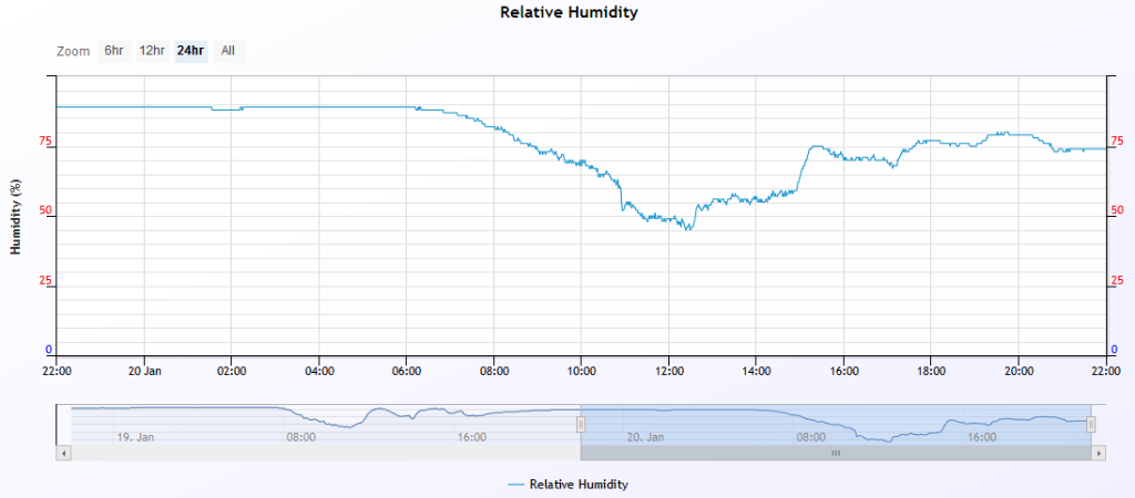   |
|
2 users thanked Falling_Droplet for this useful post.
|
|
|
|
Rank: Advanced Member
Groups: Registered
Joined: 21/08/2019(UTC) Posts: 182 Location: Wynnum North Thanks: 656 times
Was thanked: 381 time(s) in 167 post(s)
|
WYNNUM NORTH ( 27.4S 153.2E ) - WEATHER
DATE...21 JAN 2020 TIME....0720
CURRENT TEMPERATURE...26.8C
CURRENT HUMIDITY........85%
CURRENT DEW POINT.......24C
CURRENT WIND DIR/SPEED..NNE 11Kph
CURRENT VISIBILITY......30KM
CURRENT MSL PRESSURE...1/8 Sc, 6/8Ac
CURRENT WEATHER......Distant virga to SW
RAIN SINCE 0900 MONDAY..1.4mm
SUMMARY LAST 24 HOURS
YESTERDAY'S MAX TEMP.........32.0C
THIS MORNING'S MIN TEMP......24.8C
PAST 24 HOURS TEMP ANOMALY..+2.55C
THIS MORNING'S GRASS MIN.....24.6C
AVERAGE 24 HOUR DEW POINT......24C ( Max 27C - confirmed with wet and dry thermometers )
AVERAGE 24 HOUR MSLP........1007.6Hpa
PAST 24 HOURS MAX WIND GUST...N 34Kph at 1342
PAST 24 HR SIGNIFICANT WEATHER...Thunder heard from storms passing to the SW much of Monday afternoon, until a rapidly weakening storm passed over this area late afternoon. |
Wyn Nth 2020-Jan165, |
4 users thanked retired weather man for this useful post.
|
|
|
|
Rank: Advanced Member
Groups: Registered
Joined: 25/08/2019(UTC) Posts: 1,839 Location: Ferny Grove Thanks: 985 times
Was thanked: 856 time(s) in 419 post(s)
|
Ferny Grove Weather
Date: 21 Jan 2020
Time: 7:50 AM
Min Temp since 9am yesterday: 24.3 C
Max Temp since 9am yesterday: 34.7 C
Min Ground Temp: 22 C
Rain since 9am yesterday: 4.5 mm
Temperature: 26.1 C
Relative Humidity: 65 %
Dew Point: 19 C
MSL Pressure: 1009.9 hPa
Wind Speed: 3 kph - light air
Wind Direction: S
Present Weather: State of sky generally unchanged during preceding hour
Visibility: 20km to 39km - Very Good Visibility
Cloud Cover: 2/8
Ground State: Ground moist
Thunder yesterday: Yes
Notes of yesterday weather - 20/1/20: Partly cloudy with cu and sc, and cloudy at times with cu, sc, ac and cb in the afternoon. Nearby thunderstorms during the mid afternoon followed by a mild brief decaying thunderstorm at 3pm with light rain. A mild brief thunderstorm with a very short period of heavy rainfall at 5:15pm from the edge of a thunderstorm. A very warm morning and a warm day with the maximum temperature reached in the middle of the day. Before and during each afternoon afternoon storm the temperature fell with stable temperature between the two storms before becoming stable in the evening and rising slowly later in the evening. Dew point was moderately high and stable early in the day before rising during the morning reaching a high of 25 C later in the morning and falling briefly but sharply in the late morning back to average. In the afternoon the dew point briefly rose sharply moderately high before becoming stable and then fell from the late afternoon and was close to average and stable in the evening before rising later in the evening. Stable and high relative humidity early in the day becoming near average in the morning and early afternoon before generally rising from the mid afternoon and fell briefly at times. Light N to NE winds from early with some ENE to NE winds in the early morning, E to NE from the late morning, moderate winds with the 3pm storm, ENE to NE following the storm, veered to SE later in the afternoon and backing to NNW to ENE in the late afternoon with the following the late afternoon storm. In the evening winds became calm with E to NE with N to NE winds from the mid evening.
Today: Light N to NE winds, calm from 3 am, W to NW winds in the early morning, NNE to NW from 6am and have switched to S to SW in the last 20 minutes. Warm overnight with the temperature falling slowly before stabilising in the early hours of the day. Dew point have been near average and stable before becoming mostly stable in the last hour. Relative humidity have been near average today.
|
|
4 users thanked Falling_Droplet for this useful post.
|
|
|
|
Rank: Advanced Member
Groups: Registered
Joined: 25/08/2019(UTC) Posts: 1,839 Location: Ferny Grove Thanks: 985 times
Was thanked: 856 time(s) in 419 post(s)
|
4.9 mm from a brief decaying mild thunderstorm at 4pm with light to moderate rain. The storm decayed quite quickly as it moved in with not much thunder with its passage. A very warm day with the temperature with a maximum of 35 C becoming stable from midday near the maximum temperature. The temperature fell quite quickly before and with the storm from 3pm falling to a low of 25 C at 4:30pm before rising a little following the storm before falling very slowly tonight. The dew point rose during the morning through to the early afternoon and became moderately high from late in the morning to a high of 24 C. In the afternoon the dew point became stable before falling from 2pm. With the storm the dew point rose slightly before falling back to near average and became stable following the storm. Near average relative humidity today rising 24% from 3pm as the storm approached before briefly falling from 4:30pm following the storm and then rose tonight. Light SSW to SE winds during the morning, S to ESE in the mid morning backing during the rest of the morning to NNE to NE and then became E to SE from the late morning. From 2 pm winds were E to NE becoming N to NE with the storm and N to NW winds following the storm. Tonight wind veered to S to SSW at 7pm with some calm winds becoming variable with some calm winds from 8pm. Last 24 hours:  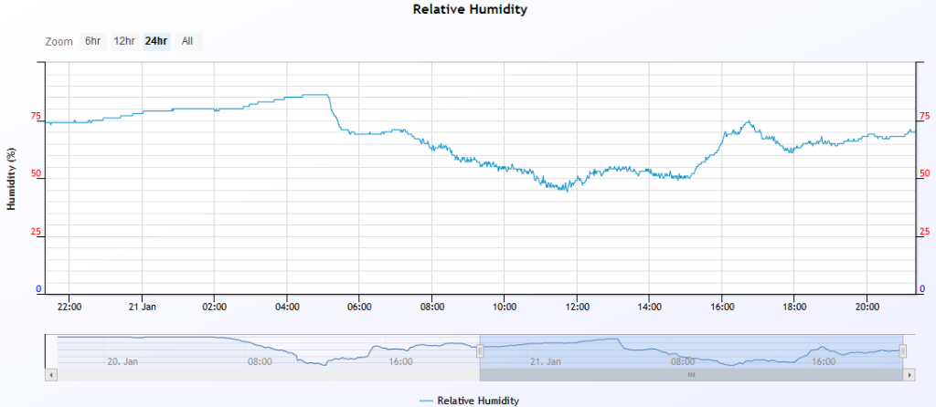  Edited by user Tuesday, 21 January 2020 9:49:17 PM(UTC)
| Reason: Not specified |
|
1 user thanked Falling_Droplet for this useful post.
|
|
|
|
Rank: Advanced Member
Groups: Registered
Joined: 25/08/2019(UTC) Posts: 1,839 Location: Ferny Grove Thanks: 985 times
Was thanked: 856 time(s) in 419 post(s)
|
Ferny Grove Weather Date: 22 Jan 2020 Time: 7:25 AM Min Temp since 9am yesterday: 21.4 C Max Temp since 9am yesterday: 35.3 C Min Ground Temp: 20.7 C Rain since 9am yesterday: 5 mm Temperature: 25.5 C Relative Humidity: 65 % Dew Point: 18.4 C MSL Pressure: 1011.8 hPa Wind Speed: 4 kph - light air Wind Direction: N Present Weather: State of sky generally unchanged during preceding hour Visibility: 20km to 39km - Very Good Visibility Cloud Cover: 2/8 Ground State: Ground moist Thunder yesterday: Yes Notes of yesterday weather - 21/1/20: Partly cloudy with sc and ac clouds clearing to sunny skies during the morning with some cu clouds. Increasing cu, cb,ci, cs and ac clouds with an approaching storm becoming partly cloudy following the storm with cu, sc and ac clouds. A very warm day after a warm night with the temperature falling slowly in the early hours. The temperature became stable in the early afternoon close to the maximum temperature before falling sharply from 3pm as the cloud increased ahead of the storm. The temperature stopped falling at 4pm and after briefly rising fell from the late afternoon close to average. The dew point was near average and stable early in the day becoming stable during the morning. The dew point rose during the morning, became moderately high from the late morning and became stable in the afternoon. In the mid afternoon the dew point fell before rising slightly with the storm and fell again to near average after the storm and then became stable soon afterwards. Relative humidity was near average from early in the day rising 24% in 90 minutes in the mid afternoon ahead and with the storm before dropping back to near average from the late afternoon. Light N to NE winds early in the day with some calm winds, W to NW becoming NNE to NW in the early morning and S to SW during the morning followed by S to ESE winds in the mid morning. Following this the wind backed to NNE to NE and then E to SE in the late morning and from 2pm was E to NE followed by N to NE with the storm and N to NW after the storm. In the evening winds veered to S to SSW in the early evening before variable winds from 8pm with some calm winds. Today: Dew point and relative humidity have been near average and stable today with near average temperature also. Calm winds in the early hours of today before NE to NW winds since 6:30am. Edited by user Thursday, 23 January 2020 8:06:32 AM(UTC)
| Reason: Not specified |
|
1 user thanked Falling_Droplet for this useful post.
|
|
|
|
Rank: Advanced Member
Groups: Registered
Joined: 21/08/2019(UTC) Posts: 182 Location: Wynnum North Thanks: 656 times
Was thanked: 381 time(s) in 167 post(s)
|
WYNNUM NORTH ( 27.4S 153.2E ) - WEATHER
DATE...22 JAN 2020 TIME....0845
CURRENT TEMPERATURE...28.8C
CURRENT HUMIDITY........75%
CURRENT DEW POINT.......24C
CURRENT WIND DIR/SPEED..NNE 16Kph
CURRENT VISIBILITY......30KM
CURRENT MSL PRESSURE...1012.3 Hpa,
CURRENT CLOUD..........1/8 Ac, 5/8 CiCc,
CURRENT WEATHER......No significant weather
RAIN SINCE 0900 TUESDAY..Trace
SUMMARY LAST 24 HOURS
YESTERDAY'S MAX TEMP.........32.6C
THIS MORNING'S MIN TEMP......22.4C
PAST 24 HOURS TEMP ANOMALY..+1.65C
THIS MORNING'S GRASS MIN.....21.0C
AVERAGE 24 HOUR DEW POINT......24C ( Max DP 28C - highest ever recorded here )
AVERAGE 24 HOUR MSLP........1009.3Hpa
PAST 24 HOURS MAX WIND GUST...NE 39Kph at 1504
PAST 24 HR SIGNIFICANT WEATHER...Thunder heard from storms to the west mid afternoon. By late afternoon a storm showing hail echoes on the radar only 10km away, headed straight for this area, but the seabreeze
collapsed it and only a trace of rain was recorded. |
Wyn Nth 2020-Jan165, |
|
|
|
|
|
Rank: Advanced Member
Groups: Registered
Joined: 25/08/2019(UTC) Posts: 1,839 Location: Ferny Grove Thanks: 985 times
Was thanked: 856 time(s) in 419 post(s)
|
|
|
1 user thanked Falling_Droplet for this useful post.
|
|
|
|
Rank: Advanced Member
Groups: Registered
Joined: 21/08/2019(UTC) Posts: 182 Location: Wynnum North Thanks: 656 times
Was thanked: 381 time(s) in 167 post(s)
|
WYNNUM NORTH ( 27.4S 153.2E ) - WEATHER
DATE...23 JAN 2020 TIME....0735
CURRENT TEMPERATURE...26.8C
CURRENT HUMIDITY........90%
CURRENT DEW POINT.......25C
CURRENT WIND DIR/SPEED..NE 16Kph
CURRENT VISIBILITY......20KM
CURRENT MSL PRESSURE...1013.8 Hpa,
CURRENT CLOUD..........4/8 Cu, 6/8 Ac, 1/8 Cc
CURRENT WEATHER......Nearby showers
RAIN SINCE 0900 WEDNESDAY..Trace
SUMMARY LAST 24 HOURS
YESTERDAY'S MAX TEMP.........32.8C
THIS MORNING'S MIN TEMP......26.3C
PAST 24 HOURS TEMP ANOMALY..+3.70C
THIS MORNING'S GRASS MIN.....25.3C
AVERAGE 24 HOUR DEW POINT......25C ( Max 27C )
AVERAGE 24 HOUR MSLP........1010.8Hpa
PAST 24 HOURS MAX WIND GUST...N 46Kph at 1709
PAST 24 HR SIGNIFICANT WEATHER...Slight rain overnight and early morning. No rain recorded. |
Wyn Nth 2020-Jan165, |
1 user thanked retired weather man for this useful post.
|
|
|
|
Weather Forum
»
Australia Weather
»
SEQ and NE NSW
»
SE QLD and NE NSW - Day to Day Weather
Forum Jump
You cannot post new topics in this forum.
You cannot reply to topics in this forum.
You cannot delete your posts in this forum.
You cannot edit your posts in this forum.
You cannot create polls in this forum.
You cannot vote in polls in this forum.
Important Information:
The Weather Forum uses cookies. By continuing to browse this site, you are agreeing to our use of cookies.
More Details
Close
